The Congo River Basin: Home of the deepest river in the world
By Holly Secon 2 hours ago
The Congo River Basin has a remarkable natural and cultural history.
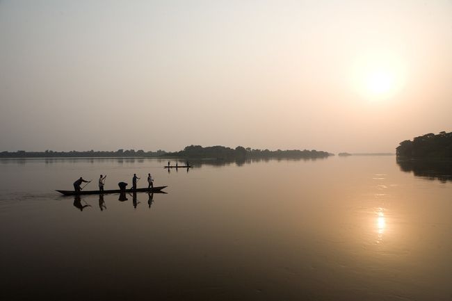
The Congo River at sunset in the Democratic Republic of the Congo.
(Image: © UN Photo/Marie Frechon)
The Congo River is a long, arcing river with a basin that spans nine countries in West-Central Africa. This extensive body of water provides food, water, medicine and transport to about 75 million people in the surrounding basin, according to Yale University's Global Forest Atlas.
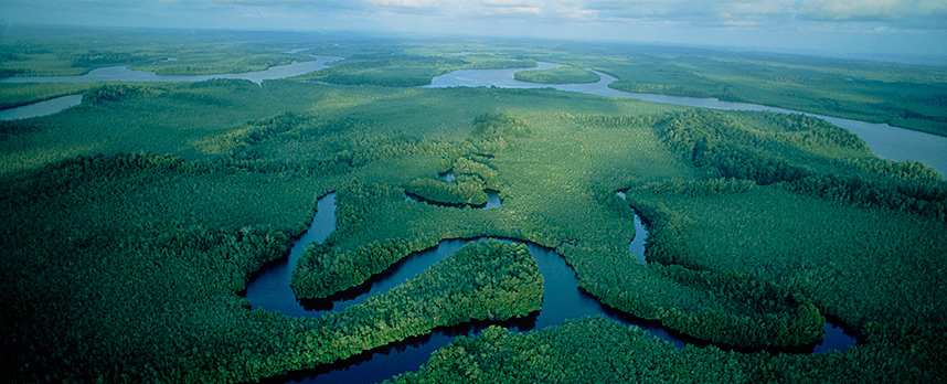
The Congo River zigzags across the equator twice as it flows from eastern Africa, through the Congo rainforest, all the way to the Atlantic Ocean, according to Mongabay, a nonprofit environmental science and conservation news site. From its tributaries to where it meets the Atlantic Ocean, the massive river includes rapids, wetlands, floodplains, lakes and swamps.
In addition, the Congo River is the world's deepest recorded river at 720 feet (220 meters) deep in parts — too deep for light to penetrate, The New York Times reported. It's also the second-longest river in Africa, spanning a length of approximately 2,920 miles (4,700 kilometers), according to Phys.org. (Africa's Nile River is the longest river in the world at 4,135 miles, or 6,650 km long.) That makes the Congo River the ninth-longest in the world.
The region surrounding the Congo River holds an abundance of valuable resources, from ivory to rubber to timber, the BBC reported. "It's this massive freshwater heart of Africa," said Melanie Stiassny, an expert in Congolese ichthyology and curator at the American Museum of Natural History.
Governments have long fought for control of the Congo; the brutal colonial regime of the infamous King Leopold II of Belgium from 1885 to 1908, memorialized in the 1899 novella, "Heart of Darkness," by Joseph Conrad, was one of the bloodiest.
More:
https://www.livescience.com/congo-river.html
~ ~ ~
Cloudy Congo River Basin
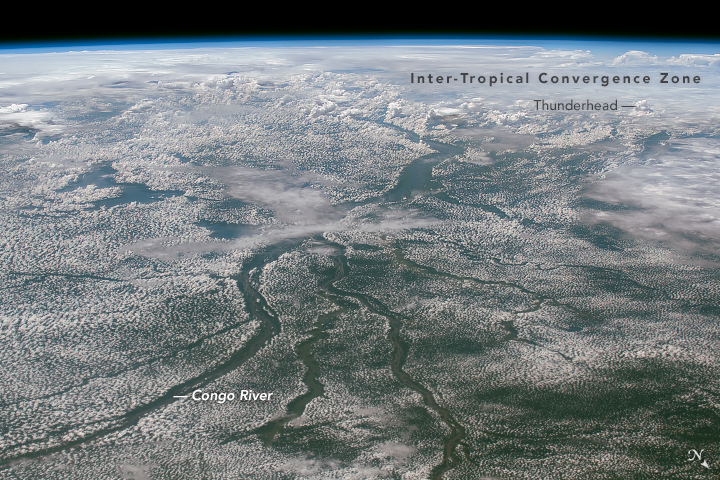
November 5, 2018JPEG
An astronaut onboard the International Space Station captured this oblique photograph while looking southwest across the Congo River Basin. Located along the equator, the area is one of the cloudiest places on Earth. Low-altitude cumulus clouds, sometimes called popcorn clouds, trace the landscape over dense rainforests in this shot.
Note, however, that the skies above the Congo River and its many tributaries are noticeably free of clouds. The river can be up to 5 kilometers (3 miles) wide in many places—enough to deter cloud formation. Warm, humid air rises from the forest and cools as it rises, resulting in the development of clouds. But the river waters—and the air above them—are cooler, so there is less moisture rising into the air. Similar cloud patterns are common in the Amazon Rainforest.
Toward the horizon, larger storm clouds are forming along the Inter-Tropical Convergence Zone. The ITCZ is a broad region of low atmospheric pressure that encircles the Earth near the equator. The ITCZ and its thunderstorms follow the seasonal position of the Sun, such that large storms appear south of the equator during Southern Hemisphere summer (when this image was taken).
https://earthobservatory.nasa.gov/images/144608/cloudy-congo-river-basin
 = new reply since forum marked as read