Welcome to DU! The truly grassroots left-of-center political community where regular people, not algorithms, drive the discussions and set the standards. Join the community: Create a free account Support DU (and get rid of ads!): Become a Star Member Latest Breaking News General Discussion The DU Lounge All Forums Issue Forums Culture Forums Alliance Forums Region Forums Support Forums Help & Search

tanyev

(42,552 posts)
1. I want to call attention to this excellent theory proposed by a Talking Points Memo reader:
Sat Jul 11, 2020, 11:26 AM
Jul 2020
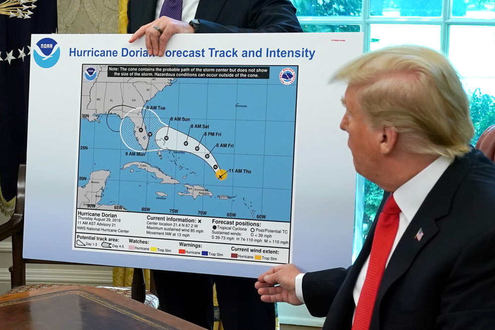
There is another possibly comical aspect to SharpieGate that I don’t think has been commented on, even when the event was first being reported. It’s true that the line drawn on the map does include part of Alabama, but the actual area of Alabama’s coastline included in the circle is minuscule. To the untrained eye, it might appear that the longitudinal line that bisects Florida’s panhandle on the map is the Alabama border but, of course, that is not true. I always assumed that Trump mistook the portion of the Florida panhandle that lies to the west of the longitudinal line for the coastline of Alabama. In fact, Trump’s alteration seems designed to highlight only the Florida panhandle.

I think that it was Trump’s inability to correctly read a map that precipitated this entire mess. It would make perfect sense to believe that Alabama might be impacted by Dorian if you didn’t actually know where Florida ends and Alabama begins.

https://talkingpointsmemo.com/edblog/sharpie-hurricane-trump-noaa


Latest Discussions»General Discussion»IG report puts 'Sharpiega...»Reply #1