Thanksgiving travel weather forecast: Stormy for western, central U.S.
Source: USA Today
Doyle Rice,
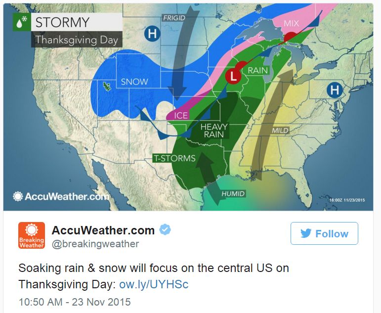
Weather-related Thanksgiving travel problems this week will be confined mainly to the western and central U.S., while the eastern third of the nation enjoys mostly tranquil weather.
West: Travel troubles will start Tuesday as a potent winter storm cranks up over the Northwest and northern Rockies. Heavy snow is likely at higher elevations of the Cascades, Rockies and Sierra Tuesday and into Wednesday.
Blizzard conditions could develop in parts of Montana and Wyoming by Wednesday, according to AccuWeather.
Lower elevations will see rain, especially near the coast. Seattle, Portland and San Francisco should all see a wet, cool, windy day Tuesday.
FULL story at link.
Read more: http://www.usatoday.com/story/weather/2015/11/23/thanksgiving-travel-weather-forecast/76273162/
We only have an 8 mile drive to get to our family party.
http://www.accuweather.com/en/us/omaha-ne/68102/weather-warnings/349291
Severe Weather Alerts - Omaha, NE
...WINTER STORM WATCH IN EFFECT FROM THURSDAY MORNING THROUGH
THURSDAY EVENING...
THE NATIONAL WEATHER SERVICE IN OMAHA/VALLEY HAS ISSUED A WINTER
STORM WATCH...WHICH IS IN EFFECT FROM THURSDAY MORNING THROUGH
THURSDAY EVENING.
* TIMING...RAIN WILL CHANGE TO FREEZING RAIN AND SLEET BY AROUND
MIDDAY CLOSE TO INTERSTATE 80...AND BY AROUND SUNSET IN
SOUTHEAST NEBRASKA AND SOUTHWEST IOWA. LIGHT SNOW ACCUMULATION
MAY THEN FOLLOW THE ICE AND SLEET ON THURSDAY EVENING INTO
THURSDAY NIGHT.
* ICE AND SNOW ACCUMULATIONS...FREEZING RAIN MAY BRING SIGNIFICANT
ICE ACCUMULATION OF UP TO A TENTH TO A QUARTER INCH DURING THE
DAY ON THURSDAY...FOLLOWED BY AN ACCUMULATION OF SLEET AND THEN
AN INCH OR LESS OF SNOW.
* OTHER IMPACTS...NORTH WINDS OF 15 TO 20 MPH...WITH HIGHER
GUSTS...ARE POSSIBLE ON THURSDAY INTO FRIDAY. SHOULD SIGNIFICANT
ICING MATERIALIZE...THE COMBINATION OF ICE AND WIND MAY CREATE
POWER OUTAGES. ICE...SLEET...AND SNOW COULD CREATE TREACHEROUS
TRAVEL CONDITIONS ON THANKSGIVING DAY INTO EARLY FRIDAY.
PRECAUTIONARY/PREPAREDNESS ACTIONS...
A WINTER STORM WATCH MEANS THERE IS A POTENTIAL FOR SIGNIFICANT
SNOW...SLEET...OR ICE ACCUMULATIONS THAT MAY IMPACT TRAVEL.
CONTINUE TO MONITOR THE LATEST FORECASTS.
 = new reply since forum marked as read
